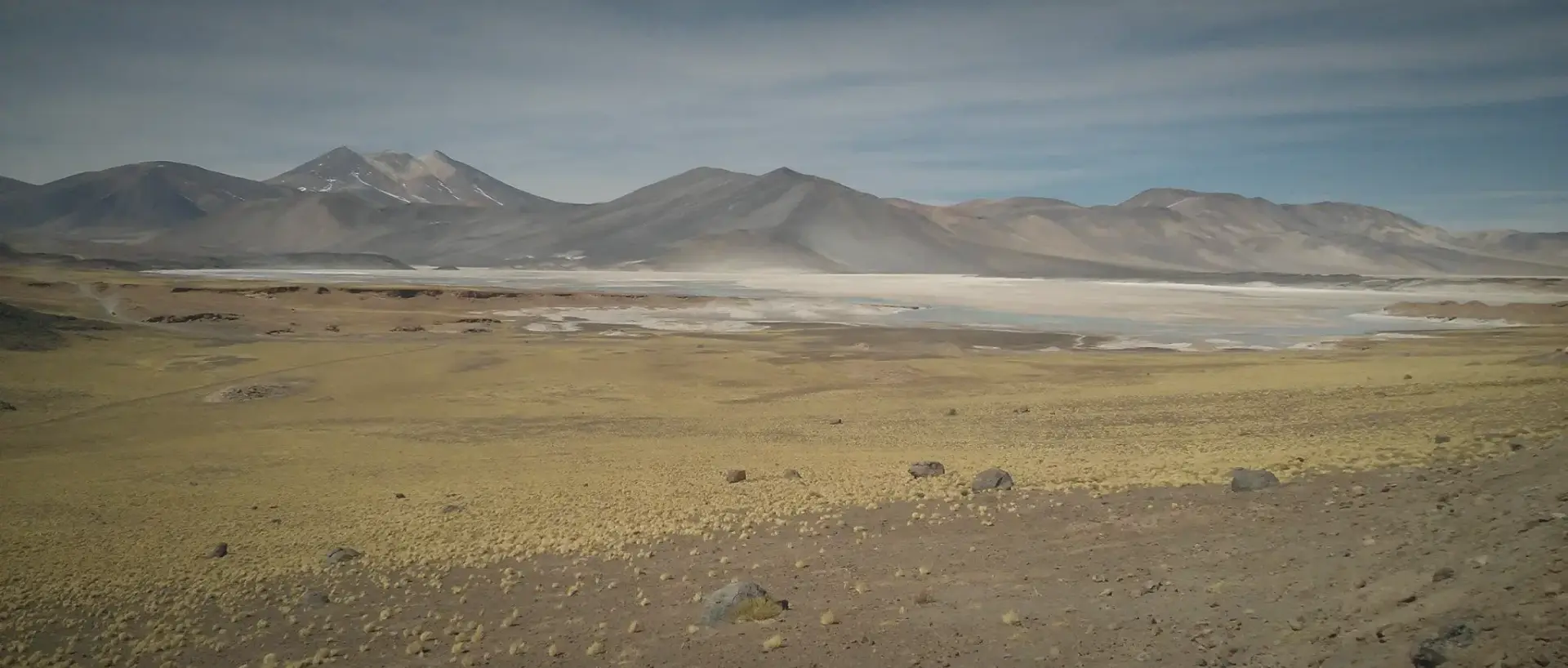
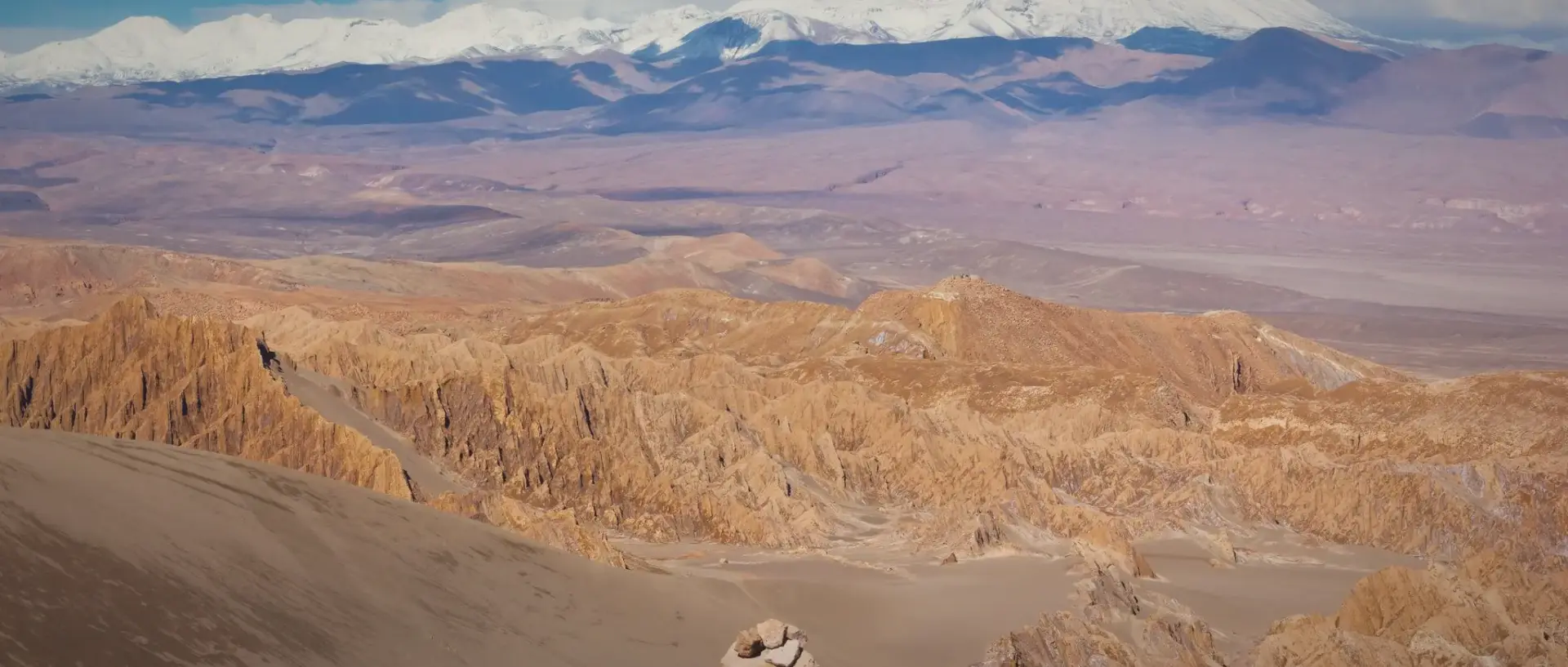
The high-altitude plains around El Tatio create some of the most striking open
landscapes in northern Chile. These wide Andean areas feel quiet, spacious, and
completely different from busy city life, making them a special highlight for
nature-focused travelers.
As you travel through the plains, you will notice big horizons, distant mountain
shapes, and a natural atmosphere that feels untouched. The air is thin because of
the elevation, but the scenery is rewarding, especially for travelers who enjoy
peaceful views and natural photography.
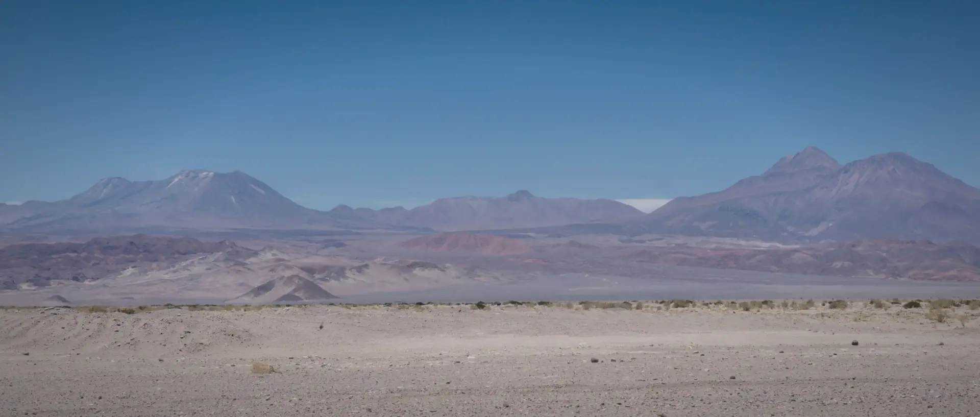
If you want to experience the true Andean environment during your El Tatio visit, the
high-altitude plains are a perfect part of the journey and offer beautiful viewpoints
along the road.
- 🏔️ Enjoy open Andean landscapes where the vast Altiplano meets the sky at 4,000+ meters altitude 🌋 ✨
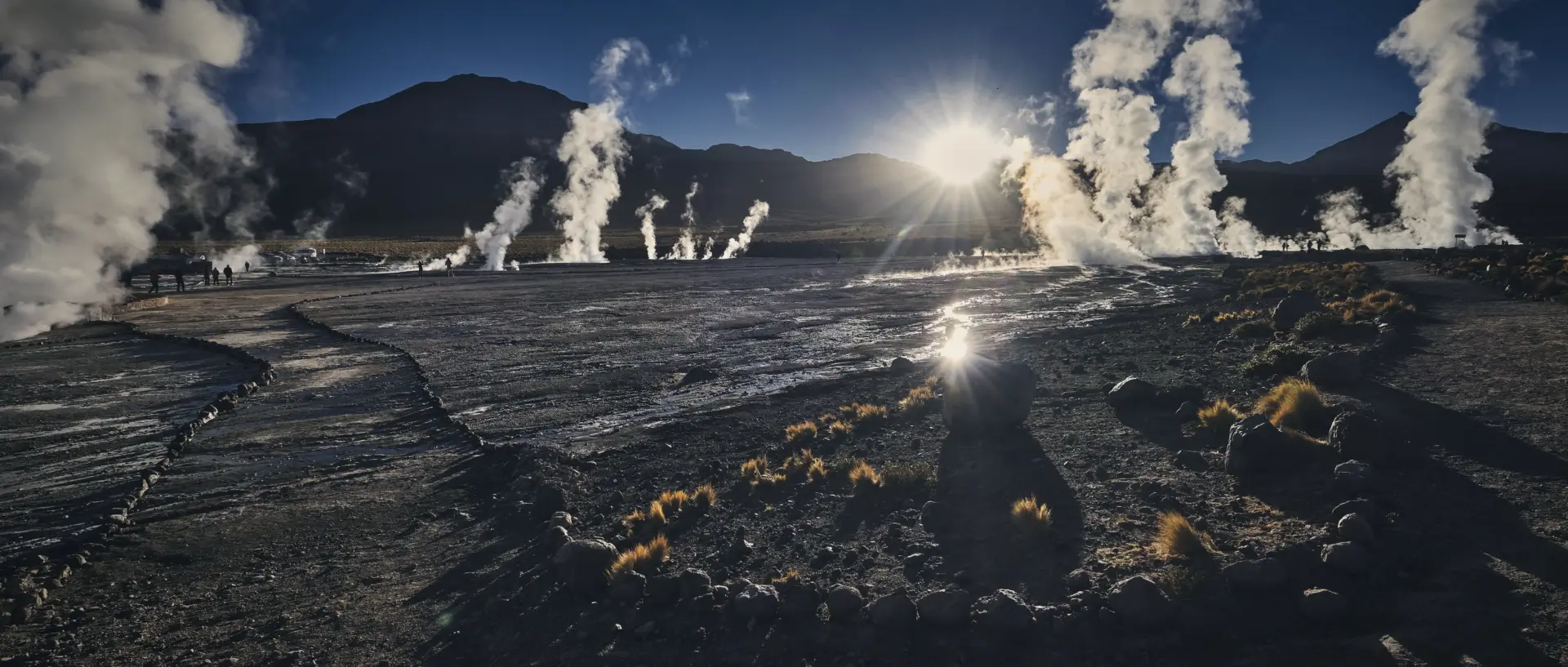
- 📸 Take scenic photos of plains, textured salt crusts, and the perfect silhouettes of the Licancabur volcano 🎞️ 📸
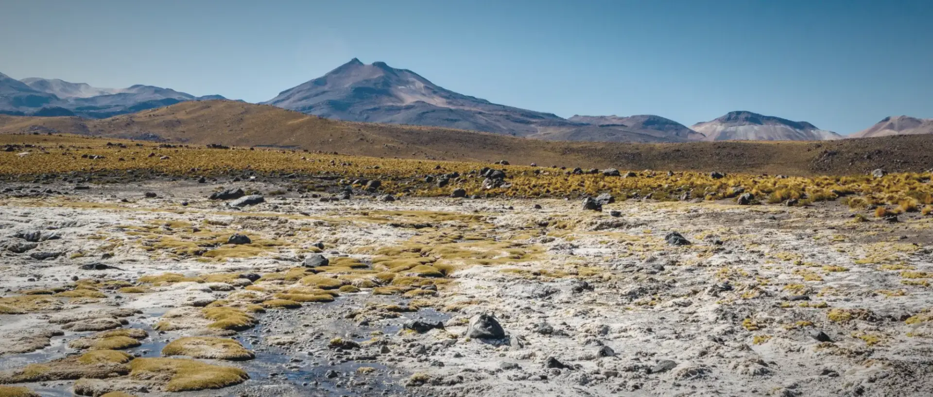
- 💧 Stop at safe viewpoints like Mirador Putana to watch the river wind through the high-desert wetlands 🦆 🧘
- 🧘 Experience the quiet atmosphere of the highlands, broken only by the sound of the wind across the pajonal grass 🌬️ 🧘
- 🎨 Observe changing light and colors as the sunrise transitions from deep indigo to vibrant desert gold 🌅 🎨
- 🚐 Journey by guided tour, as these scenic plains are a featured stop on all El Tatio Geyser excursions 🚍 🏁
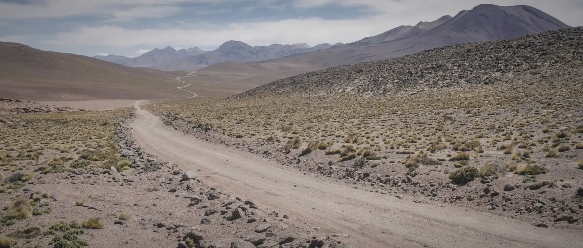
- 🚗 Travel by car for independent exploration; the B-245 is paved for much of the way but requires a 4×4 for off-road viewpoints 🏎️ 🏁
- 🚐 Rely on tours for the most reliable option, as high-altitude driving can be taxing and there is no public transport to these remote vistas 🚍 📍
- 🧥 Dress warm in multiple layers; temperatures at dawn can be -15°C, even if San Pedro is warm ❄️ 🛡️
- 💧 Move slowly and stay hydrated with small sips of water to prevent “soroche” (altitude sickness) 🚶 🛡️
- 🍎 Keep a light snack with you, such as nuts or chocolate, to maintain energy levels in the oxygen-thin air 🍫 🛡️
- 🕶️ Use sunglasses and high-SPF sunscreen, as the UV rays are significantly more intense at these elevations ☀️ 🛡️
- 🐢 Do not rush the journey; the most dramatic views often appear at unmarked bends in the mountain road 📸 🛡️
http://googleusercontent.com/map_location_reference/3
- 4:30 AM – Start the drive from San Pedro toward [El Tatio](http://googleusercontent.com/map_location_reference/2) to reach the highlands before the first light 🚗 🧣
- 5:30 AM – Enjoy wide high-altitude plains scenery as the horizon begins to turn deep purple and blue 📍 🌌
- 6:15 AM – Stop at safe points, such as the Vado Río Putana, for quick photography moments of the steaming river 🎞️ 📸
- 7:00 AM – Continue toward the geothermal field for the main sunrise viewing and a warm breakfast 🍳 🌅
- 10:00 AM – Return back to town, enjoying the panoramic views of the “Valley of the Cacti” on your way down 🌵 🏁